




La Pineda Playa / News / Beaches
Salou Coastal Path (Camí de Costa)
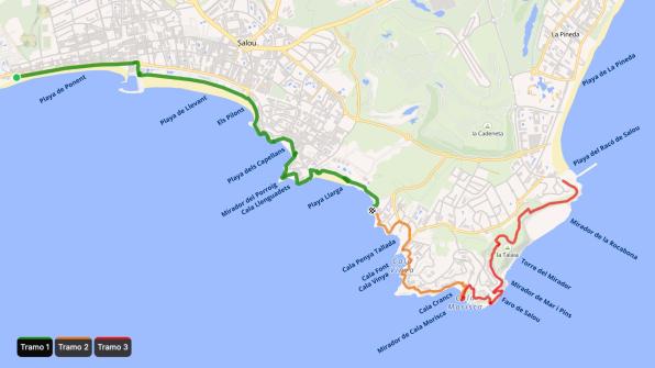
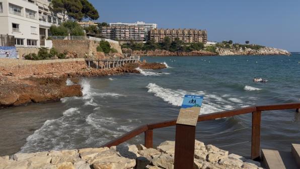
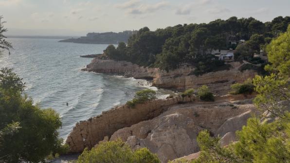
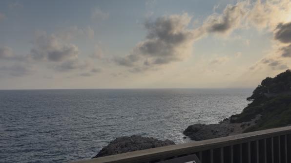
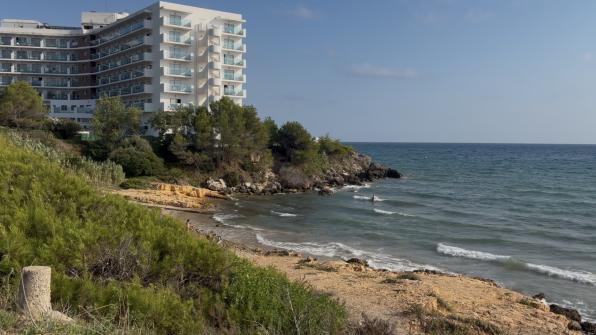
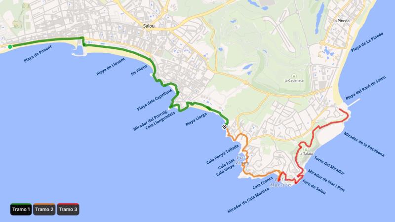
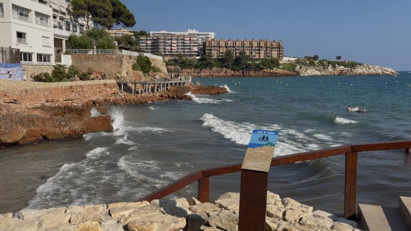
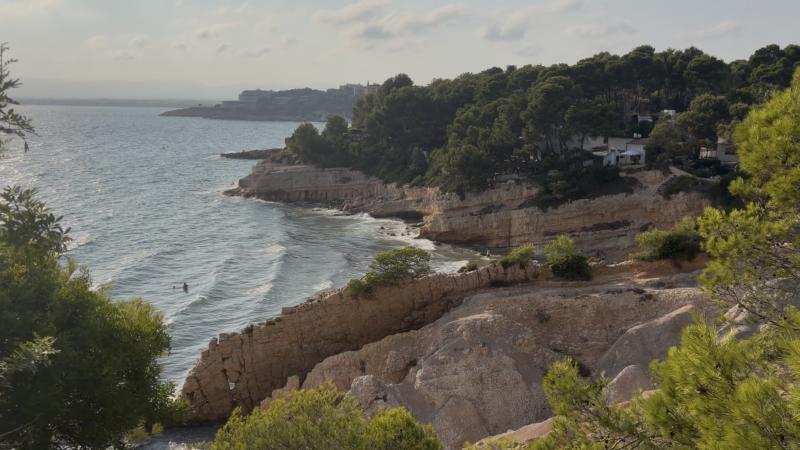
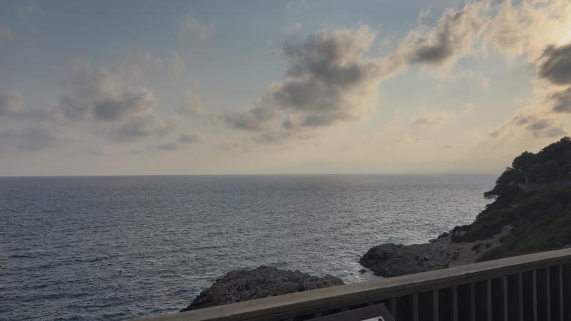
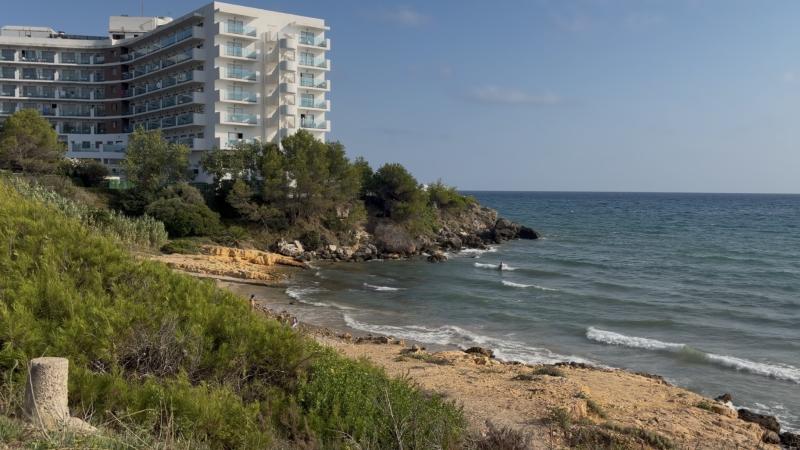
The Coastal Path (Camí de Costa) is one of Salou's great natural attractions. This 9-kilometer coastal trail runs through the municipality's Mediterranean landscape among coves, beaches, and viewpoints, from Punta de Sant Pere, in the area of Passeig Miramar and Plaça Venus, to Racó de Salou, on the border with Cap Salou and La Pineda.
The route passes through some of the most emblematic spaces of the Salou coastline, such as Capellans beach, Llarga beach, Cala Font, or Cala Crancs. The route, with a maximum height of 77 meters above sea level, combines accessible sections with more natural ones, featuring stairs, uneven ground, and rocky passages. The difficulty varies depending on the chosen section: the first few kilometers are accessible to everyone, while the last ones present more elevation changes and natural passages.
The origin of the Coastal Path:
The Coastal Path is part of the ancient coastal patrol paths (camins de ronda) that ran along the Catalan coast. These paths served to guard the coast, control smuggling, and facilitate the movement of fishermen and residents of coastal areas.
Over the years, many of these paths fell into disuse due to the transformation of the coastline. The restoration of Salou's Coastal Path has made it possible to reconnect these spaces and offer visitors a new way to discover the municipality's landscape and history.
Points of interest:
- Els Pilons, one of the most famous points in Salou and one of the first viewpoints on the route.
- Capellans beach, where you can see the remains of the old Salou lazaretto (quarantine station), built in 1829 to house crews that could carry contagious diseases.
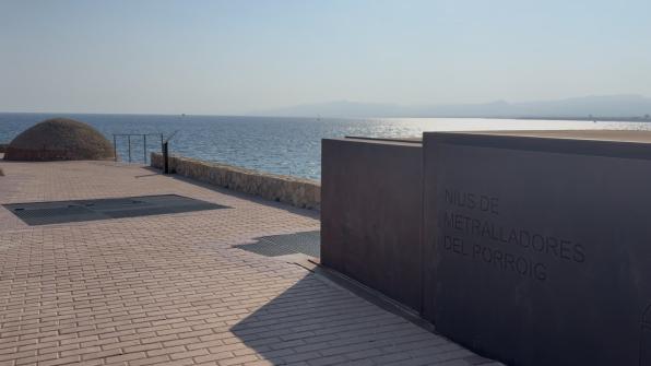
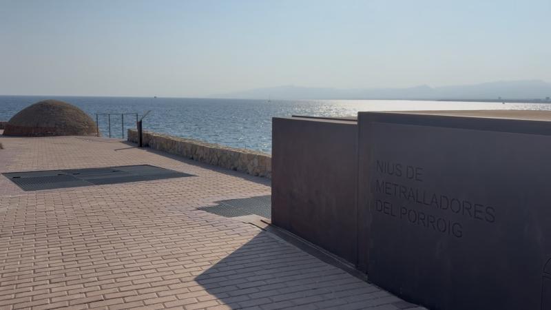
- The Porroig viewpoint, from where you can see the old bunkers built during the Civil War called machine gun nests, as well as Cala Llenguadets.
- Llarga beach, one of the most natural areas of the Salou coastline, along with its viewpoint.
- The more than 20 viewpoints along the coast, such as Mirador de la Punta Daurada, Mirador de la Punta Roja, Mirador de la Punta del Cavall, Mirador del Port de Tarragona, Mirador de la Falconera…
- Small coves surrounded by cliffs and Mediterranean vegetation: Cala Penya Tallada, Cala Font, Cala Vinya, and Cala Crancs.
- The Salou lighthouse and its viewpoint, which allows you to listen to the natural environment as it is removed from city noise.
- Punta Prima at La Pineda beach, where the Coastal Path ends.
The three sections of the Salou Coastal Path:
The approximately 9-kilometer route can be divided into three sections depending on terrain characteristics and difficulty level.
Section 1: Punta de Sant Pere – Els Replanells (5.03 km)
This section, which starts at Punta de Sant Pere (Passeig Miramar - Plaça Venus area) and ends at Els Replanells, is the most accessible and recommended for all audiences. The route passes through the most urban areas of Salou and combines promenades with wooden boardwalk sections, offering a comfortable and easy-to-follow itinerary. During this first section you can visit:
- Ponent beach
- Llevant beach
- Els Pilons
- Capellans beach, from where the old Salou lazaretto can be seen
- Porroig viewpoint, where the machine gun nests are located
- Cala Llenguadets
- Llarga beach
The path is equipped with benches, handrails, and rest areas, making it an ideal option for a quiet walk. One of the most photographed spots in this section is Els Pilons, an ideal place for a family photo with the promenade, Llevant beach, and the Mediterranean in the background.
Section 2: Els Replanells – Cala Crancs (2.17 km)
It is the most representative section of the traditional Camí de Ronda and the one that shows the most natural side of Cap Salou.
The route passes through:
- Cala Penya Tallada
- Cala Font
- Cala Vinya
- Cala Crancs
- Cala Morisca viewpoint
As you move forward, urban elements disappear to give way to natural trails, stairs, and some passages over rock. It is the section with the greatest elevation change and difficulty on the Coastal Path, but also one of the most spectacular, thanks to its viewpoints with sweeping views over the Mediterranean.
From one of the viewpoints you can also contemplate Cala Morisca. This cove was the hiding place of Muslim pirates, who waited hidden there before attacking ships taking refuge in the natural port of Salou. It is also one of the best spots on the Coastal Path to take a couple's photo, thanks to the panoramic view of the cliffs and the turquoise waters of the Mediterranean.
Section 3: Cala Crancs – Racó de Salou (2.78 km)
The last part of the route passes through a quieter area, surrounded by Mediterranean forest and several points on the Viewpoints Route (Ruta dels Miradors).
During the last section you can visit:
- Salou Lighthouse
- Mirador de Mar i Pins
- Torre del Mirador
- Mirador de la Rocabona
- Racó de Salou beach
The Salou Lighthouse was inaugurated in 1858 and is located at one of the highest points of the municipality's coastline. Surrounding it is a viewpoint overlooking the Mediterranean Sea, a birdwatching viewpoint from which you can observe the fauna of this environment, and a large Compass Rose, which make this space a key point on the Coastal Path. It is thus an ideal place to contemplate and photograph the sunset and birds.
This is a less crowded and wilder section, with uneven paths and some slopes, so it is not the most recommended for children or people with reduced mobility. The route continues to Racó de Salou, on the border with La Pineda, where the Coastal Path ends.
Recommendations for enjoying the Coastal Path
To get the most out of the route, it is recommended to:
- Wear comfortable and suitable footwear, especially if you want to complete the entire route.
- Bring water, sun protection, and a hat, especially during the hottest months.
- Check the route map before starting, as there are adapted sections and others with stairs or more irregular terrain.
- Do the route in stages if traveling with children or if a more relaxed walk is preferred.
- Avoid the hottest hours in summer and take advantage of the early morning or sunset.
- Respect the natural environment, especially areas of Mediterranean vegetation and spaces of environmental interest.
The Coastal Path is an ideal option for discovering the Salou coastline on foot and enjoying its natural landscapes, beaches, and heritage. A route suitable for both residents and visitors who want to discover another side of the municipality.
REQUEST MORE INFORMATION BY EMAIL




Booking hotels